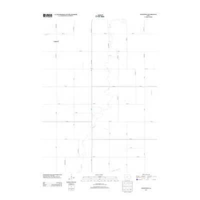
2013 Map of Wightman
USGS Topo · Published 2013About this map
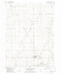
Wightman sits at the intersection of Preston Ave and 380th St in this 2013 topographical study of the Iowa agricultural landscape. The township is defined by a rigorous grid of section lines and gravel roads, including Quinton Ave and Red Oak Ave, which cross a terrain shaped by persistent watercourses. The local hydrology is dominated by the meandering path of Cedar Creek as it flows southward, joined by smaller tributaries like Happy Run. Evidence of the managed agricultural environment is clear through features like Drainage Ditch Number 121 in the southern portion of the quadrangle. This map provides a detailed look at the rural infrastructure of Greene County, documenting the specific placement of farmsteads and the network of local roads that have supported the region's farming economy for generations.
Find a feature on this map
32 named features on this map. Tap any name to fly to it.
Don’t see what you’re looking for? This feature index may not catch every label — zoom into the map to look around manually.
Map Details
Editions of this 2013 Wightman Map
This is the sole edition of this map. No revisions or reprints were ever made.
Other maps of this area

1954 · Fort Dodge
USGS Topo · 1:250,000

1957 · Fort Dodge
USGS Topo · 1:250,000

1958 · Fort Dodge
USGS Topo · 1:250,000

1962 · Jefferson
USGS Topo · 1:62,500

1965 · Farnhamville
USGS Topo · 1:24,000
1980 · Glidden
USGS Topo · 1:24,000

1980 · Wightman
USGS Topo · 1:24,000
1980 · Scranton
USGS Topo · 1:24,000
1980 · Lanesboro
USGS Topo · 1:24,000
1980 · Lohrville
USGS Topo · 1:24,000