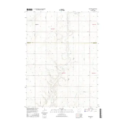
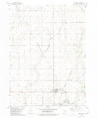
2015 Map of Wightman
USGS Topo · Published 2015About this map
Cedar Creek meanders through the heart of this agricultural landscape along the border of Calhoun and Greene counties. The settlement of Wightman sits at a crossroads in the northwest, serving as a focal point for the surrounding farmsteads. The terrain is defined by its watercourses, including the curiously named Purgatory Cr and Happy Run, alongside the engineered Drainage Ditch Number 121 which illustrates the region's managed drainage systems. Genealogists and local historians will find significant value in the distribution of rural burial grounds, such as Evergreen Cem in the north, Old Cedar Cem near the center, and Saint Patricks Cem further south. These landmarks, connected by a rigid grid of local roads like Co Hwy N65 and Co Hwy E19, provide a clear picture of the established community structure in this part of Iowa.
Find a feature on this map
40 named features on this map. Tap any name to fly to it.
Don’t see what you’re looking for? This feature index may not catch every label — zoom into the map to look around manually.
Map Details
Editions of this 2015 Wightman Map
This is the sole edition of this map. No revisions or reprints were ever made.
Other maps of this area

1954 · Fort Dodge
USGS Topo · 1:250,000

1957 · Fort Dodge
USGS Topo · 1:250,000

1958 · Fort Dodge
USGS Topo · 1:250,000

1962 · Jefferson
USGS Topo · 1:62,500

1965 · Farnhamville
USGS Topo · 1:24,000
1980 · Glidden
USGS Topo · 1:24,000

1980 · Wightman
USGS Topo · 1:24,000
1980 · Scranton
USGS Topo · 1:24,000
1980 · Lanesboro
USGS Topo · 1:24,000
1980 · Lohrville
USGS Topo · 1:24,000