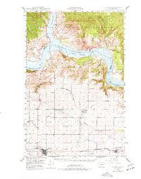
1948 Map of Wilbur
USGS Topo · Published 1977About this map
The town of Wilbur serves as the focal point of this 1940s landscape, situated along the Burlington Northern railroad in the Big Bend country of Washington. The map details a significant period of transition following the creation of Franklin D Roosevelt Lake, where the impounded Columbia River and Sanpoil River meet. This newly formed reservoir within the National Recreational Area is contrasted by the high plateau to the south, where dryland farming and small communities like Sherman and Creston are established. To the north, the Colville Indian Reservation spans the rugged terrain across the water, accessible via the Lincoln Co Ferry. Local social life is evidenced by the Potlatch Grange, while the deep cuts of Penix Canyon and Moyer Canyon reveal the complex topography leading down to the river banks.
Find a feature on this map
35 named features on this map. Tap any name to fly to it.
Don’t see what you’re looking for? This feature index may not catch every label — zoom into the map to look around manually.
Map Details
Editions of this 1948 Wilbur Map
2 editions found
Other maps of this area

1948 · Grand Coulee Dam
USGS Topo · 1:62,500

1948 · Wilbur
USGS Topo · 1:62,500

1948 · Wilmont Creek
USGS Topo · 1:62,500

1948 · Lincoln
USGS Topo · 1:62,500

1950 · Lincoln
USGS Topo · 1:62,500

1950 · Wilmont Creek
USGS Topo · 1:62,500

1950 · Wilbur
USGS Topo · 1:62,500

1950 · Grand Coulee Dam
USGS Topo · 1:62,500

1950 · Nespelem
USGS Topo · 1:62,500

1952 · Keller
USGS Topo · 1:62,500