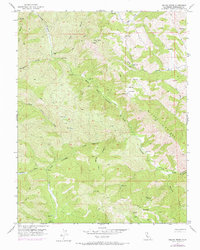
1956 Map of Wilcox Ridge
USGS Topo · Published 1972About this map
Wilcox Ridge and the surrounding Diablo Range backcountry define this topographic study, updated in the early 1970s from 1950s surveys. The landscape is characterized by a dense network of seasonal drainages and rugged canyons, including Gooseberry Canyon, Sheep Canyon, and Beartrap Canyon. Human presence is sparse, centered on isolated holdings like Isom Ranch, which features its own Landing Strip, and Miller Ranch to the south.
Find a feature on this map
32 named features on this map. Tap any name to fly to it.
Don’t see what you’re looking for? This feature index may not catch every label — zoom into the map to look around manually.
Map Details
Editions of this 1956 Wilcox Ridge Map
3 editions found
Other maps of this area

1916 · Patterson
USGS Topo · 1:31,680

1919 · Orestimba
USGS Topo · 1:62,500

1919 · Orestimba Creek
USGS Topo · 1:31,680

1920 · Pacheco Pass
USGS Topo · 1:62,500

1921 · Gilroy Hot Springs
USGS Topo · 1:62,500

1938 · Mt. Boardman
USGS Topo · 1:62,500

1939 · Gilroy Hot Springs
USGS Topo · 1:62,500

1940 · Gilroy Hot Springs
USGS Topo · 1:62,500

1940 · Pacheco Pass
USGS Topo · 1:62,500

1941 · Orestimba
USGS Topo · 1:62,500