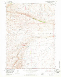
1953 Map of Wild Horse Mountain
USGS Topo · Published 1971About this map
Wild Horse Mountain dominates this portion of Carbon County, where high ridges and intricate drainages define the high desert landscape. The terrain is marked by significant geological formations including Cheyenne Ridge, Windy Ridge, and the Coal Creek Rim, showcasing a rugged topography of canyons such as Corral Canyon and Blind Canyon. Human activity in this mid-century period is largely confined to grazing and resource extraction, evidenced by Tapers Ranch and the mining-related Coal Draw in the northeast corner.
Find a feature on this map
17 named features on this map. Tap any name to fly to it.
Don’t see what you’re looking for? This feature index may not catch every label — zoom into the map to look around manually.
Map Details
Editions of this 1953 Wild Horse Mountain Map
3 editions found
Other maps of this area

1893 · Fort Steele
USGS Topo · 1:125,000

1914 · Walcott
USGS Topo · 1:62,500

1953 · Bradley Peak
USGS Topo · 1:24,000

1953 · Seminoe Dam
USGS Topo · 1:24,000

1953 · Wild Horse Mountain
USGS Topo · 1:24,000

1953 · Seminoe Dam SW
USGS Topo · 1:24,000

1953 · Ferris
USGS Topo · 1:24,000

1953 · Riddle Cut
USGS Topo · 1:24,000

1953 · Lone Haystack Mountain
USGS Topo · 1:24,000

1953 · Rawlins NW
USGS Topo · 1:24,000