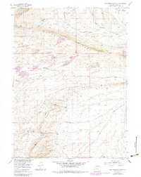
1953 Map of Wild Horse Mountain
USGS Topo · Published 1983About this map
Wild Horse Mountain rises as a central landmark in this high-desert landscape of Carbon County, Wyoming. The terrain is defined by dramatic geological formations, including the Haystack Mountains and the extensive Coal Creek Rim. This mid-century survey captures a sparsely populated ranching and mining region where water sources like Cheyenne Spring and creeks such as Bothwell Creek and Rankin Creek were vital for survival.
Find a feature on this map
16 named features on this map. Tap any name to fly to it.
Don’t see what you’re looking for? This feature index may not catch every label — zoom into the map to look around manually.
Map Details
Editions of this 1953 Wild Horse Mountain Map
3 editions found
Other maps of this area

1893 · Fort Steele
USGS Topo · 1:125,000

1914 · Walcott
USGS Topo · 1:62,500

1953 · Bradley Peak
USGS Topo · 1:24,000

1953 · Seminoe Dam
USGS Topo · 1:24,000

1953 · Wild Horse Mountain
USGS Topo · 1:24,000

1953 · Seminoe Dam SW
USGS Topo · 1:24,000

1953 · Ferris
USGS Topo · 1:24,000

1953 · Riddle Cut
USGS Topo · 1:24,000

1953 · Lone Haystack Mountain
USGS Topo · 1:24,000

1953 · Rawlins NW
USGS Topo · 1:24,000