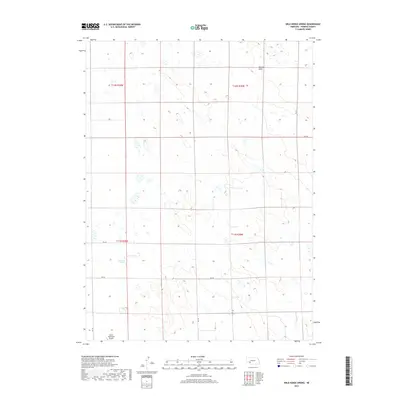
2017 Map of Wild Horse Spring
USGS Topo · Published 2017About this map
Wild Horse Spring provides a focal point for this landscape in the western Nebraska sandhills of Perkins County. The terrain is defined by undulating landforms and ephemeral drainage patterns such as Roscoe Draw in the northeastern corner. Human activity is largely concentrated along a rectilinear grid of section roads, including Rd 764 and Rd 765, which navigate the township boundaries of T11N and T12N. In the southwest corner, the Grant Municipal Airport stands as a modern landmark near the edge of the survey area. This 2017 study reflects the late 20th and early 21st-century agricultural and transportation layout of the region, where pivot irrigation and rural road networks like 331 St Rd have shaped the modern high plains environment.
Find a feature on this map
14 named features on this map. Tap any name to fly to it.
Don’t see what you’re looking for? This feature index may not catch every label — zoom into the map to look around manually.
Map Details
Editions of this 2017 Wild Horse Spring Map
This is the sole edition of this map. No revisions or reprints were ever made.
Other maps of this area

1897 · Ogallala
USGS Topo · 1:125,000

1900 · Ogallala
USGS Topo · 1:125,000

1954 · McCook
USGS Topo · 1:250,000

1954 · North Platte
USGS Topo · 1:250,000

1956 · North Platte
USGS Topo · 1:250,000

1957 · North Platte
USGS Topo · 1:250,000

1957 · McCook
USGS Topo · 1:250,000

1958 · McCook
USGS Topo · 1:250,000

1961 · Brandon NE
USGS Topo · 1:24,000

1961 · Brandon SE
USGS Topo · 1:24,000