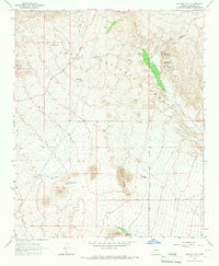
1965 Map of Wildcat Hill
USGS Topo · Published 1967About this map
Browns Ranch stands as a primary point of human settlement in this mid-1960s desert landscape, located near the intersection of several unnamed trails. The terrain is defined by prominent peaks including Wildcat Hill, Granite Mountain, and Lone Mountain, which rise above a network of seasonal watercourses and drainage washes. Much of the eastern portion of the map is protected within the Tonto National Forest, where the boundary separates federal lands from the surrounding desert scrub.
Find a feature on this map
20 named features on this map. Tap any name to fly to it.
Don’t see what you’re looking for? This feature index may not catch every label — zoom into the map to look around manually.
Map Details
Editions of this 1965 Wildcat Hill Map
3 editions found
Other maps of this area

1904 · Camelback
USGS Topo · 1:62,500

1904 · Ft. McDowell
USGS Topo · 1:62,500

1906 · Camelsback
USGS Topo · 1:62,500

1906 · Ft. McDowell
USGS Topo · 1:62,500

1930 · Cave Creek
USGS Topo · 1:125,000

1939 · Cave Creek
USGS Topo · 1:125,000

1954 · Mesa
USGS Topo · 1:250,000

1957 · Mesa
USGS Topo · 1:250,000

1958 · Mesa
USGS Topo · 1:250,000

1960 · Mesa
USGS Topo · 1:250,000