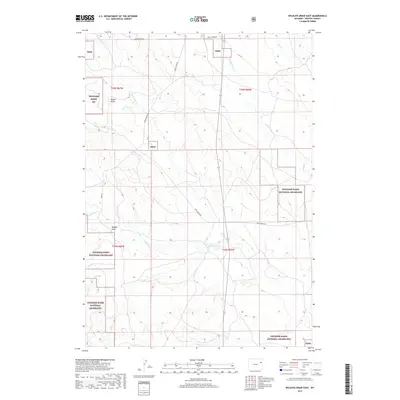
2017 Map of Wildlife Draw East
USGS Topo · Published 2017About this map
Thunder Basin National Grassland dominates this portion of Weston County, illustrating a landscape defined by high plains watercourses and sparse rural infrastructure. The drainage patterns of Lodgepole Cr and Lone Tree Cr carve through the terrain, joined by the upper reaches of Hay Cr and its W Fork Hay Cr. This 2017 survey reveals the land's character through its network of remote thoroughfares like Raven Creek Rd and Christensen Rd, which provide access to a region primarily used for grazing and conservation. Notable geological features such as Rough Draw and Wildcat Draw break the surface, indicating the subtle but persistent erosion typical of this high-desert environment. The map preserves the exact boundaries of several townships, showing the intersection of public land management and local geography.
Find a feature on this map
15 named features on this map. Tap any name to fly to it.
Don’t see what you’re looking for? This feature index may not catch every label — zoom into the map to look around manually.
Map Details
Editions of this 2017 Wildlife Draw East Map
This is the sole edition of this map. No revisions or reprints were ever made.
Other maps of this area

1955 · Newcastle
USGS Topo · 1:250,000

1958 · Newcastle
USGS Topo · 1:250,000

1979 · Newcastle
USGS Topo · 1:100,000
1982 · Darlington Draw West
USGS Topo · 1:24,000
1982 · Wildlife Draw West
USGS Topo · 1:24,000

1982 · Clareton
USGS Topo · 1:24,000
1982 · Sheep Canyon Creek West
USGS Topo · 1:24,000
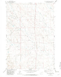
1982 · Wildlife Draw East
USGS Topo · 1:24,000
1982 · Darlington Draw East
USGS Topo · 1:24,000
1982 · Raven
USGS Topo · 1:24,000