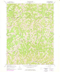
1960 Map of Wileyville
USGS Topo · Published 1977About this map
The rugged ridge-and-valley topography of Wetzel and Marshall counties defines this survey, captured before the full maturation of the region's energy infrastructure. Small rural communities like Saint Joseph and Millsboro are connected by narrow winding roads that follow the high ground of Pleasant Ridge and Macedonia Ridge. The landscape is dominated by extractive industry, with a dense network of Gas Wells and Oil Wells scattered across the drainages of Whetstone Creek and Little Fishing Creek.
Find a feature on this map
66 named features on this map. Tap any name to fly to it.
Don’t see what you’re looking for? This feature index may not catch every label — zoom into the map to look around manually.
Map Details
Editions of this 1960 Wileyville Map
2 editions found
Other maps of this area

1903 · Littleton
USGS Topo · 1:62,500

1904 · Cameron
USGS Topo · 1:62,500

1905 · Littleton
USGS Topo · 1:62,500

1905 · Clarington
USGS Topo · 1:62,500

1906 · New Martinsville
USGS Topo · 1:62,500

1924 · New Martinsville
USGS Topo · 1:62,500

1924 · Littleton
USGS Topo · 1:62,500

1926 · Littleton
USGS Topo · 1:62,500

1926 · New Martinsville
USGS Topo · 1:62,500

1935 · Cameron
USGS Topo · 1:62,500