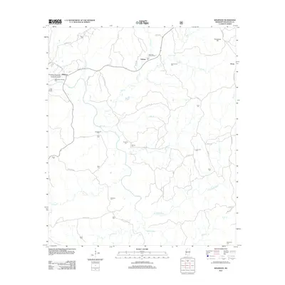
2012 Map of Wilkinson
USGS Topo · Published 2012About this map
Saukum and the surrounding timberlands of Wilkinson County define this landscape during the early 21st century. The local economy is visibly shaped by the timber and petroleum industries, anchored by the Fred Netterville Lumber Company/Wilkinson Community Airport and the Netterville Landing Strip. The map reveals a dense network of active extraction sites, including the Saukum Oil Field and the North Mud Creek Oil Field, interspersed between the drainages of the Buffalo River and the Little Buffalo River. Genealogists will find a wealth of family-named landmarks and burial sites throughout the territory, such as Whetstone Cem, McCrain Cem, and Shropshire Cem. These small cemeteries are tucked away off routes like Whites School Rd and Sam Leake Rd, marking the generational footprint of rural Mississippi families. The terrain transitions from the heights of Greenwood Hill down to the creek bottoms of Silver Cr and Willis Br.
Find a feature on this map
61 named features on this map. Tap any name to fly to it.
Don’t see what you’re looking for? This feature index may not catch every label — zoom into the map to look around manually.
Map Details
Editions of this 2012 Wilkinson Map
This is the sole edition of this map. No revisions or reprints were ever made.
Other maps of this area

1936 · Woodville
USGS Topo · 1:62,500

1939 · Kingston
USGS Topo · 1:62,500

1953 · Natchez
USGS Topo · 1:250,000

1956 · Natchez
USGS Topo · 1:250,000

1958 · Woodville
USGS Topo · 1:62,500

1958 · Kingston
USGS Topo · 1:62,500

1959 · Natchez
USGS Topo · 1:250,000

1961 · Crosby
USGS Topo · 1:62,500

1961 · Gloster
USGS Topo · 1:62,500

1984 · Woodville
USGS Topo · 1:100,000