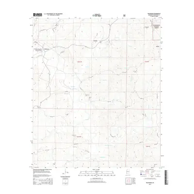
2015 Map of Wilkinson
USGS Topo · Published 2015About this map
The Buffalo River and Little Buffalo River wind through the hills and hollows of Wilkinson County, anchoring a landscape defined by timber and deep family roots. Industry and transport converge at the Fred Netterville Lumber Company/Wilkinson Community Airport, reflecting the region's long-standing reliance on forest resources. The map captures small settlements like Saukum, Wilkinson, and Hiram, while the northeastern corner reaches into the Homochitto National Forest near Greenwood Hill.
Find a feature on this map
58 named features on this map. Tap any name to fly to it.
Don’t see what you’re looking for? This feature index may not catch every label — zoom into the map to look around manually.
Map Details
Editions of this 2015 Wilkinson Map
This is the sole edition of this map. No revisions or reprints were ever made.
Other maps of this area

1936 · Woodville
USGS Topo · 1:62,500

1939 · Kingston
USGS Topo · 1:62,500

1953 · Natchez
USGS Topo · 1:250,000

1956 · Natchez
USGS Topo · 1:250,000

1958 · Woodville
USGS Topo · 1:62,500

1958 · Kingston
USGS Topo · 1:62,500

1959 · Natchez
USGS Topo · 1:250,000

1961 · Crosby
USGS Topo · 1:62,500

1961 · Gloster
USGS Topo · 1:62,500

1984 · Woodville
USGS Topo · 1:100,000