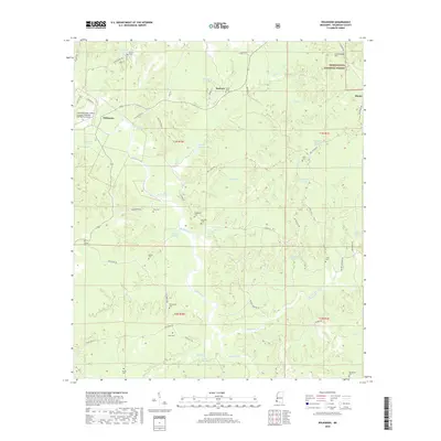
2018 Map of Wilkinson
USGS Topo · Published 2018About this map
Buffalo River and the complex network of Belmont Slough dominate this corner of Wilkinson County, carving through a landscape defined by timber and traditional family landholdings. In the northwest, the Fred Netterville Lumber Company Wilkinson Community Airport stands near the settlement of Wilkinson, serving as a modern anchor in a region otherwise characterized by its deep ties to the Homochitto National Forest.
Find a feature on this map
59 named features on this map. Tap any name to fly to it.
Don’t see what you’re looking for? This feature index may not catch every label — zoom into the map to look around manually.
Map Details
Editions of this 2018 Wilkinson Map
This is the sole edition of this map. No revisions or reprints were ever made.
Other maps of this area

1936 · Woodville
USGS Topo · 1:62,500

1939 · Kingston
USGS Topo · 1:62,500

1953 · Natchez
USGS Topo · 1:250,000

1956 · Natchez
USGS Topo · 1:250,000

1958 · Woodville
USGS Topo · 1:62,500

1958 · Kingston
USGS Topo · 1:62,500

1959 · Natchez
USGS Topo · 1:250,000

1961 · Crosby
USGS Topo · 1:62,500

1961 · Gloster
USGS Topo · 1:62,500

1984 · Woodville
USGS Topo · 1:100,000