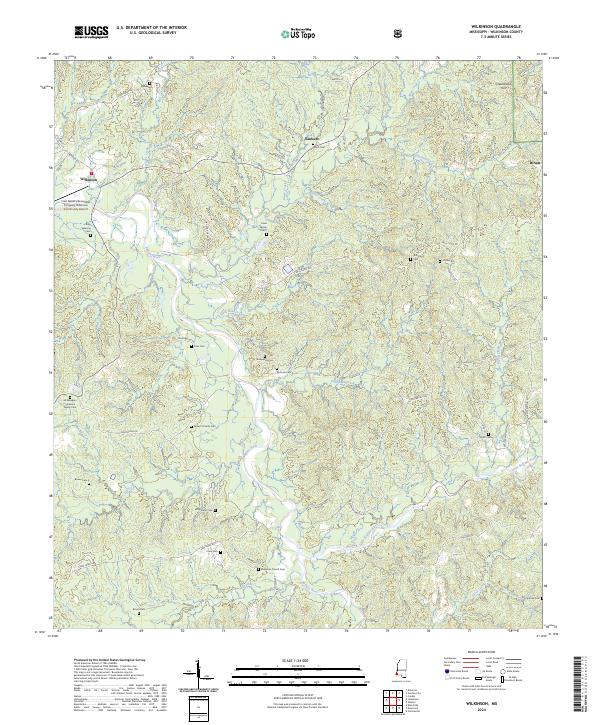
2024 Map of Wilkinson
USGS Topo · Published 2024About this map
The Buffalo River and Little Buffalo River wind through the timberlands of Wilkinson County, anchoring a landscape shaped by rural industry and family lineages. The Fred Netterville Lumber Company Wilkinson Community Airport stands near the settlement of Wilkinson, signaling the economic importance of the regional lumber trade. This area is heavily defined by small family and community burial grounds, including the Cavin Family Cem 5, Sims Cem, and Whetstone Cem, which are scattered among the ridges and creek bottoms. In the northern reaches, the Homochitto National Forest covers the terrain around Greenwood Hill, while the small community of Saukum sits at a junction near Union Cem. The network of local routes like Netterville Rd and Whetstone Rd provides access to these isolated sites, tracing the historical movement of residents between the river forks and upland farms.
Find a feature on this map
63 named features on this map. Tap any name to fly to it.
Don’t see what you’re looking for? This feature index may not catch every label — zoom into the map to look around manually.
Map Details
Editions of this 2024 Wilkinson Map
This is the sole edition of this map. No revisions or reprints were ever made.
Other maps of this area

1936 · Woodville
USGS Topo · 1:62,500

1939 · Kingston
USGS Topo · 1:62,500

1953 · Natchez
USGS Topo · 1:250,000

1956 · Natchez
USGS Topo · 1:250,000

1958 · Woodville
USGS Topo · 1:62,500

1958 · Kingston
USGS Topo · 1:62,500

1959 · Natchez
USGS Topo · 1:250,000

1961 · Crosby
USGS Topo · 1:62,500

1961 · Gloster
USGS Topo · 1:62,500

1984 · Woodville
USGS Topo · 1:100,000