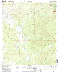
2000 Map of Wilkinson
USGS Topo · Published 2002About this map
Buffalo River meanders through the western heart of Wilkinson County, defining a landscape of deep creek drainages and timbered ridges within the Homochitto National Forest. At the turn of the millennium, this area preserved a dispersed rural settlement pattern anchored by community landmarks like St Luke Ch, Ebenezer Ch, and the Union Ch near Saukum. The map reveals a high density of family-named burial sites, including Whetstone Cem, McCrain Cem, and Shropshire Cem, which serve as vital touchstones for local genealogy. Transportation is dominated by winding local routes such as Coons Mill Road and Netterville Road, alongside the specialized Netterville Landing Strip. The presence of the Washington Meridian and several gravel extraction sites like the Gravel Pit near Greenwood Hill underscores the region's surveying history and its reliance on local natural resources.
Find a feature on this map
50 named features on this map. Tap any name to fly to it.
Don’t see what you’re looking for? This feature index may not catch every label — zoom into the map to look around manually.
Map Details
Editions of this 2000 Wilkinson Map
This is the sole edition of this map. No revisions or reprints were ever made.
Other maps of this area

1936 · Woodville
USGS Topo · 1:62,500

1939 · Kingston
USGS Topo · 1:62,500

1953 · Natchez
USGS Topo · 1:250,000

1956 · Natchez
USGS Topo · 1:250,000

1958 · Woodville
USGS Topo · 1:62,500

1958 · Kingston
USGS Topo · 1:62,500

1959 · Natchez
USGS Topo · 1:250,000

1961 · Crosby
USGS Topo · 1:62,500

1961 · Gloster
USGS Topo · 1:62,500

1984 · Woodville
USGS Topo · 1:100,000