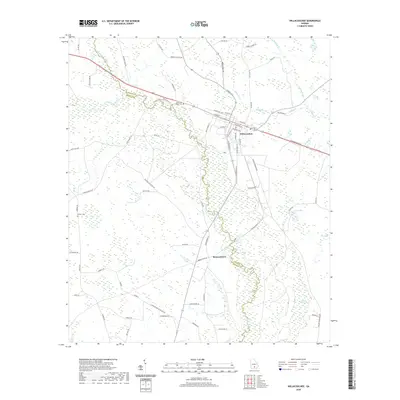
2020 Map of Willacoochee
USGS Topo · Published 2020About this map
The Willacoochee River and Alapaha River wind through this South Georgia landscape, defining the transition between Atkinson and Berrien counties. The settlement of Willacoochee serves as the central hub, where a dense grid of streets including Main St, Atlantic Ave, and McCranie Ave meet. This 2020 survey illustrates a region shaped by its water-heavy terrain, characterized by numerous depressions and wetlands like Meeting House Bay, Long Bay, and Camp Bay.
Find a feature on this map
73 named features on this map. Tap any name to fly to it.
Don’t see what you’re looking for? This feature index may not catch every label — zoom into the map to look around manually.
Map Details
Editions of this 2020 Willacoochee Map
This is the sole edition of this map. No revisions or reprints were ever made.
Other maps of this area

1953 · Waycross
USGS Topo · 1:250,000

1958 · Waycross
USGS Topo · 1:250,000

1972 · Tenmile Bay
USGS Topo · 1:24,000

1972 · Kirkland
USGS Topo · 1:24,000

1972 · Willacoochee
USGS Topo · 1:24,000

1972 · Lax
USGS Topo · 1:24,000

1972 · Henderson Still
USGS Topo · 1:24,000

1972 · Mora
USGS Topo · 1:24,000
1977 · Mora
USGS Topo · 1:24,000
1977 · Alapaha
USGS Topo · 1:24,000