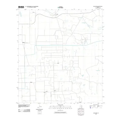
2010 Map of Willamar
USGS Topo · Published 2010About this map
Willamar Oil Field dominates the central landscape of this Willacy County coastal plain, illustrating the industrial footprint of petroleum extraction in south Texas. The area is defined by a grid of rural roads and scattered ranching operations, including the notable El Sauz Ranch to the north and El Sabinito Ranch at the southern boundary. These large landholdings are punctuated by livestock water sources such as Sacatosa Tank and Retamita Tank, which were essential for managing cattle in this semiarid environment.
Find a feature on this map
29 named features on this map. Tap any name to fly to it.
Don’t see what you’re looking for? This feature index may not catch every label — zoom into the map to look around manually.
Map Details
Editions of this 2010 Willamar Map
This is the sole edition of this map. No revisions or reprints were ever made.
Other maps of this area

1921 · Tarida Ranch
USGS Topo · 1:62,500

1930 · La Leona
USGS Topo · 1:24,000

1932 · Combes
USGS Topo · 1:31,680

1933 · Paso Real
USGS Topo · 1:31,680

1936 · La Leona
USGS Topo · 1:31,680

1952 · Hawk Island
USGS Topo · 1:24,000

1952 · Port Mansfield
USGS Topo · 1:24,000

1952 · South of Potrero Lopeno
USGS Topo · 1:62,500

1953 · Brownsville
USGS Topo · 1:250,000
1955 · La Leona
USGS Topo · 1:62,500