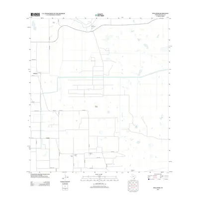
2013 Map of Willamar
USGS Topo · Published 2013About this map
Willamar Oil Field dominates this South Texas landscape, reflecting the region's mid-century industrial development through a complex network of roads and infrastructure. The area is defined by a series of working cattle operations and family-named holdings, including El Sauz Ranch, La Jarita Ranch, and El Sabinito Ranch, which maintain the tradition of large-scale land management in Willacy County.
Find a feature on this map
35 named features on this map. Tap any name to fly to it.
Don’t see what you’re looking for? This feature index may not catch every label — zoom into the map to look around manually.
Map Details
Editions of this 2013 Willamar Map
This is the sole edition of this map. No revisions or reprints were ever made.
Other maps of this area

1921 · Tarida Ranch
USGS Topo · 1:62,500

1930 · La Leona
USGS Topo · 1:24,000

1932 · Combes
USGS Topo · 1:31,680

1933 · Paso Real
USGS Topo · 1:31,680

1936 · La Leona
USGS Topo · 1:31,680

1952 · Hawk Island
USGS Topo · 1:24,000

1952 · Port Mansfield
USGS Topo · 1:24,000

1952 · South of Potrero Lopeno
USGS Topo · 1:62,500

1953 · Brownsville
USGS Topo · 1:250,000
1955 · La Leona
USGS Topo · 1:62,500