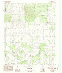
1984 Map of Willams
USGS Topo · Published 1985About this map
Williams serves as the primary focal point of this 1970s landscape, which straddles the boundary between Childress Co and Hardeman Co. The terrain is defined by a dense network of drainage systems, including the headwaters and branches of North Groesbeck Creek and Tepee Creek. The topography suggests a pastoral or ranching environment typical of the Texas Panhandle, where water sources like Papoose Creek and Squaw Creek dictated the placement of early rural infrastructure. This map, based on aerial photographs from 1977 and field checked in 1978, provides a precise record of the land surface before significant modern alterations, documenting the exact contours and minor roads that connected these isolated outposts in the late twentieth century.
Find a feature on this map
6 named features on this map. Tap any name to fly to it.
Don’t see what you’re looking for? This feature index may not catch every label — zoom into the map to look around manually.
Map Details
Editions of this 1984 Willams Map
This is the sole edition of this map. No revisions or reprints were ever made.
Other maps of this area

1954 · Plainview
USGS Topo · 1:250,000

1955 · Lawton
USGS Topo · 1:250,000

1958 · Plainview
USGS Topo · 1:250,000

1960 · Goodlett
USGS Topo · 1:62,500

1960 · Loco
USGS Topo · 1:62,500

1961 · Hollis
USGS Topo · 1:62,500

1967 · Kirkland South
USGS Topo · 1:24,000

1967 · Kirkland North
USGS Topo · 1:24,000

1975 · Hollis SE
USGS Topo · 1:24,000
1984 · Quanah West
USGS Topo · 1:24,000