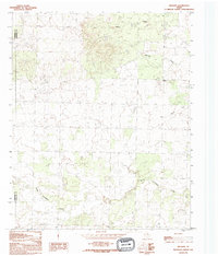
1990 Map of Willams
USGS Topo · Published 1995About this map
North Groesbeck Creek meanders through the southern reaches of this landscape, anchoring a rural Texas terrain defined by intermittent drainage systems and ranching country. The small settlement of Williams sits along the eastern edge, serving as a focal point for the surrounding prairie. This 1990 photo-inspection captures the area at a time when traditional land use patterns remained remarkably stable, with few major cultural or drainage changes recorded since the late 1970s.
Find a feature on this map
8 named features on this map. Tap any name to fly to it.
Don’t see what you’re looking for? This feature index may not catch every label — zoom into the map to look around manually.
Map Details
Editions of this 1990 Willams Map
This is the sole edition of this map. No revisions or reprints were ever made.
Other maps of this area

1954 · Plainview
USGS Topo · 1:250,000

1955 · Lawton
USGS Topo · 1:250,000

1958 · Plainview
USGS Topo · 1:250,000

1960 · Goodlett
USGS Topo · 1:62,500

1960 · Loco
USGS Topo · 1:62,500

1961 · Hollis
USGS Topo · 1:62,500

1967 · Kirkland South
USGS Topo · 1:24,000

1967 · Kirkland North
USGS Topo · 1:24,000

1975 · Hollis SE
USGS Topo · 1:24,000
1984 · Quanah West
USGS Topo · 1:24,000