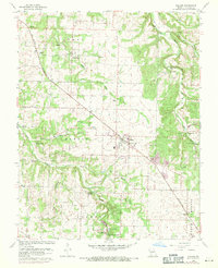
1961 Map of Willard
USGS Topo · Published 1971About this map
Willard stands at the center of this Missouri landscape, serving as a hub for the surrounding townships of Cass, Murray, Robberson, and Center. The route of the St Louis San Francisco railroad cuts diagonally across the terrain, shaping the development of local commerce and providing a lifeline for smaller stops like Ritter. The topography is defined by the winding course of the Little Sac River in the northeast and the drainage of Clear Creek and Asher Creek to the south and west.
Find a feature on this map
37 named features on this map. Tap any name to fly to it.
Don’t see what you’re looking for? This feature index may not catch every label — zoom into the map to look around manually.
Map Details
Editions of this 1961 Willard Map
4 editions found
Other maps of this area

1884 · Springfield
USGS Topo · 1:125,000

1886 · Greenfield
USGS Topo · 1:125,000

1886 · Springfield
USGS Topo · 1:125,000

1888 · Greenfield
USGS Topo · 1:125,000

1919 · Halltown
USGS Topo · 1:62,500

1935 · Springfield
USGS Topo · 1:24,000

1936 · Brookline
USGS Topo · 1:24,000

1948 · Willard
USGS Topo · 1:24,000

1948 · Ebenezer
USGS Topo · 1:24,000

1954 · Springfield
USGS Topo · 1:250,000