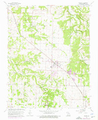
1961 Map of Willard
USGS Topo · Published 1976About this map
Willard stands at a central junction in Greene County, Missouri, where the ST Louis San Francisco railroad bisects the landscape. The township structure of Cass, Murray, Roberson, and Center is clearly visible, reflecting the rural organization of the mid-20th century. Water is a defining element of the local geography, with numerous named springs such as Cave Spring, Brower Spring, and Clear Creek Spring feeding the area's drainage systems.
Find a feature on this map
39 named features on this map. Tap any name to fly to it.
Don’t see what you’re looking for? This feature index may not catch every label — zoom into the map to look around manually.
Map Details
Editions of this 1961 Willard Map
4 editions found
Other maps of this area

1884 · Springfield
USGS Topo · 1:125,000

1886 · Greenfield
USGS Topo · 1:125,000

1886 · Springfield
USGS Topo · 1:125,000

1888 · Greenfield
USGS Topo · 1:125,000

1919 · Halltown
USGS Topo · 1:62,500

1935 · Springfield
USGS Topo · 1:24,000

1936 · Brookline
USGS Topo · 1:24,000

1948 · Willard
USGS Topo · 1:24,000

1948 · Ebenezer
USGS Topo · 1:24,000

1954 · Springfield
USGS Topo · 1:250,000