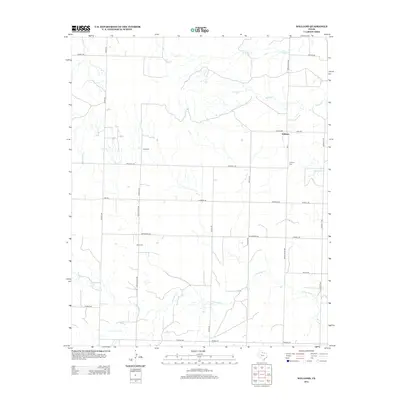
2012 Map of Williams
USGS Topo · Published 2012About this map
Williams serves as the focal point of this North Texas landscape, where a grid of rural roads and cattle-country infrastructure defines the modern geography. The terrain is deeply etched by a network of seasonal watercourses, including N Groesbeck Cr in the south and the northern drainage of Tepee Cr, Pappoose Cr, and Squaw Cr. Family and community history is preserved across the plains at Elba Cem, Scott Cem, and Johnson Cem, markers of early settlement in Hardeman County. The presence of the RR 1 corridor and thoroughfares like FM-268 and Ranch Road 680 illustrate the enduring importance of transportation to this ranching and agricultural region. This survey provides a precise view of property boundaries and local landmarks as they existed in the early 21st century.
Find a feature on this map
33 named features on this map. Tap any name to fly to it.
Don’t see what you’re looking for? This feature index may not catch every label — zoom into the map to look around manually.
Map Details
Editions of this 2012 Williams Map
This is the sole edition of this map. No revisions or reprints were ever made.
Other maps of this area

1954 · Plainview
USGS Topo · 1:250,000

1955 · Lawton
USGS Topo · 1:250,000

1958 · Plainview
USGS Topo · 1:250,000

1960 · Goodlett
USGS Topo · 1:62,500

1960 · Loco
USGS Topo · 1:62,500

1961 · Hollis
USGS Topo · 1:62,500

1967 · Kirkland South
USGS Topo · 1:24,000

1967 · Kirkland North
USGS Topo · 1:24,000

1975 · Hollis SE
USGS Topo · 1:24,000
1984 · Quanah West
USGS Topo · 1:24,000