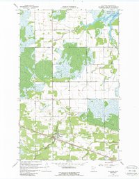
1967 Map of Williams
USGS Topo · Published 1988About this map
The town of Williams serves as the focal point of this 1960s survey, situated along the Canadian National rail line in the northern Minnesota landscape. This area is characterized by an extensive network of managed water systems, including County Ditch No 1 and various branches of Zippel Creek, which feed northward into the protected waters of Zippel Bay. The map highlights the transition from the organized grid of the settlement to the natural wetlands and forested areas preserved within Zippel Bay State Park.
Find a feature on this map
16 named features on this map. Tap any name to fly to it.
Don’t see what you’re looking for? This feature index may not catch every label — zoom into the map to look around manually.
Map Details
Editions of this 1967 Williams Map
2 editions found
Other maps of this area

1918 · Winterroad
USGS Topo · 1:62,500

1918 · Roosevelt
USGS Topo · 1:62,500

1918 · Williams
USGS Topo · 1:62,500

1919 · Peppermint Creek
USGS Topo · 1:62,500

1943 · Peppermint Creek
USGS Topo · 1:62,500

1943 · Roosevelt
USGS Topo · 1:62,500

1954 · Roseau
USGS Topo · 1:250,000

1957 · Roseau
USGS Topo · 1:250,000

1958 · Roseau
USGS Topo · 1:250,000

1967 · Williams
USGS Topo · 1:24,000