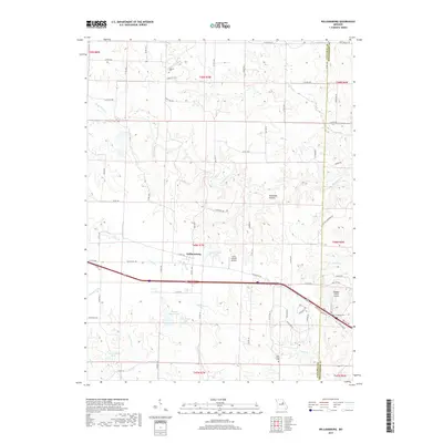
2017 Map of Williamsburg
USGS Topo · Published 2017About this map
Williamsburg serves as a central point in this part of Callaway County, where modern transit corridors intersect with long-standing rural landmarks. The landscape is defined by the headwaters of the Loutre River and the meandering Whetstone Cr, creating a series of ridges and valleys such as Sandbank Hollow. While the Interstate runs through the heart of the area, traces of older transport remain visible through segments of Old US Hwy 40 and the Old Williamsburg Rd. Genealogists and local researchers will find several significant burial sites, including Augusta Cem, Oak Grove Cem, and the Holt-Covington Cem near the Montgomery County line. The presence of private airstrips like Flying V Ranch Airport and Redgate Ranch Airport highlights the unique mix of traditional Missouri farmland and modern utility. Named water bodies such as John Gasper Lake, Eugene Hooks Lake, and Jack Knittle Lake are scattered throughout the drainage basins of Prairie Fork and Bachelor Cr.
Find a feature on this map
84 named features on this map. Tap any name to fly to it.
Don’t see what you’re looking for? This feature index may not catch every label — zoom into the map to look around manually.
Map Details
Editions of this 2017 Williamsburg Map
This is the sole edition of this map. No revisions or reprints were ever made.
Other maps of this area

1890 · Mexico
USGS Topo · 1:125,000

1890 · Fulton
USGS Topo · 1:125,000

1928 · Fulton
USGS Topo · 1:62,500

1931 · Fulton
USGS Topo · 1:62,500

1932 · Mexico
USGS Topo · 1:62,500

1940 · Montgomery City
USGS Topo · 1:62,500

1942 · Montgomery City
USGS Topo · 1:62,500

1942 · Wellsville
USGS Topo · 1:62,500

1948 · Quincy
USGS Topo · 1:250,000

1949 · Saint Louis
USGS Topo · 1:250,000