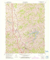
1961 Map of Williamstown
USGS Topo · Published 1987About this map
Williamstown and the surrounding Grant County countryside are defined by a complex network of ridges and deep drainage basins, captured here during a period of transition in the mid-20th century. The intricate shoreline of Williamstown Lake occupies the eastern portion of the map, fed by the South Fork Grassy Creek and Little Fork Grassy Creek. Transportation history is evident in the path of the Southern railroad, which parallels the ridge-running highways that connect the settlements of Sherman and Dry Ridge. For genealogists, the landscape is densely marked with family-named landmarks and small burial grounds, including the McGuire Cem, Conrad Cem, and Whaley Cem. The map reveals how local life was anchored by institutions like the Sherman Sch and the Mt Zion Ch, situated along historic routes such as Bannister Pike and Cason Road.
Find a feature on this map
39 named features on this map. Tap any name to fly to it.
Don’t see what you’re looking for? This feature index may not catch every label — zoom into the map to look around manually.
Map Details
Editions of this 1961 Williamstown Map
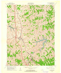
2 editions found
Other maps of this area

1929 · Alexandria
USGS Topo · 1:48,000

1930 · Falmouth
USGS Topo · 1:48,000

1936 · Alexandria
USGS Topo · 1:62,500

1936 · Falmouth
USGS Topo · 1:62,500

1950 · Mason
USGS Topo · 1:24,000

1950 · Elliston
USGS Topo · 1:24,000

1950 · Williamstown
USGS Topo · 1:24,000

1950 · Verona
USGS Topo · 1:24,000

1950 · Walton
USGS Topo · 1:24,000

1950 · Lawrenceville
USGS Topo · 1:24,000