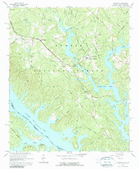
1964 Map of Willington
USGS Topo · Published 1990About this map
Clarks Hill Lake and the Savannah River define the southern landscape of this 1964 survey, where the waters meet the wooded expanse of Sumter National Forest. The map captures a moment of institutional and rural history, prominently featuring the De La Howe State School and the nearby De La Howe Tomb, providing a rare look at these landmarks alongside the Atlantic Coast Line railroad. Small settlements like Willington and Bordeaux serve as local hubs, connected by a network of country churches including St Charlottes Ch, Springfield Ch, and Holy Rock Ch. For genealogists and local historians, the inclusion of several family-scale schools such as Mims Sch No 3 and scattered burial grounds like Willington Cem offers a detailed view of the McCormick County community before later decades of change.
Find a feature on this map
41 named features on this map. Tap any name to fly to it.
Don’t see what you’re looking for? This feature index may not catch every label — zoom into the map to look around manually.
Map Details
Editions of this 1964 Willington Map
3 editions found
Other maps of this area

1892 · Mc Cormick
USGS Topo · 1:125,000

1892 · Abbeville
USGS Topo · 1:125,000

1893 · Elberton
USGS Topo · 1:125,000

1906 · Crawfordville
USGS Topo · 1:125,000

1912 · Mc Cormick
USGS Topo · 1:125,000

1948 · Verdery
USGS Topo · 1:24,000

1949 · Calhoun Creek
USGS Topo · 1:24,000

1950 · Verdery
USGS Topo · 1:24,000

1953 · Athens
USGS Topo · 1:250,000

1954 · Metasville
USGS Topo · 1:24,000