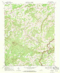
1968 Map of Willis
USGS Topo · Published 1971About this map
Willis sits at the heart of this late-1960s topographic study, surrounded by the high ridges and deep drainages of the Blue Ridge mountains. The landscape is defined by the massive presence of Buffalo Mtn, topped with its Buffalo Mtn Lookout Tower, and the prominent spine of Buffalo Ridge. Cultural life is marked by numerous rural congregations, including Blue Ridge Ch, Union Ch, and Skyline Ch, reflecting the dispersed nature of these upland communities.
Find a feature on this map
39 named features on this map. Tap any name to fly to it.
Don’t see what you’re looking for? This feature index may not catch every label — zoom into the map to look around manually.
Map Details
Editions of this 1968 Willis Map
2 editions found
Other maps of this area

1889 · Hillsville
USGS Topo · 1:125,000

1892 · Hillsville
USGS Topo · 1:125,000

1896 · Hillsville
USGS Topo · 1:125,000

1928 · Stuart
USGS Topo · 1:48,000

1931 · Stuart
USGS Topo · 1:62,500

1953 · Winston-Salem
USGS Topo · 1:250,000

1955 · Winston-Salem
USGS Topo · 1:250,000

1956 · Macks Mountain
USGS Topo · 1:62,500

1957 · Mount Airy
USGS Topo · 1:62,500

1957 · Floyd
USGS Topo · 1:62,500