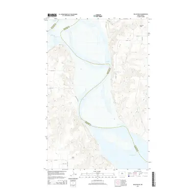
2014 Map of Williston SE
USGS Topo · Published 2014About this map
Lake Sakakawea dominates this western North Dakota landscape, where the waters of the Missouri River fill the deep breaks along the border of Williams and McKenzie counties. The terrain is defined by dramatic elevation changes, notably at Crazy Man Coulee in the northeast and the dissected uplands surrounding Indian Cr and Willow Cr. This 2014 survey documents the modern infrastructure of the Bakken region, including the rural Lindvig Airstrip and a network of section-line roads like 132nd Ave NW and 49th St NW. The presence of Legion Park Loop Rd near the lakeshore suggests recreational access points along the complex, winding shoreline. The map provides a clear record of the interface between the high plains and the massive reservoir, showing how modern transportation routes navigate the prehistoric drainage patterns and coulees of the Badlands fringe.
Find a feature on this map
19 named features on this map. Tap any name to fly to it.
Don’t see what you’re looking for? This feature index may not catch every label — zoom into the map to look around manually.
Map Details
Editions of this 2014 Williston SE Map
This is the sole edition of this map. No revisions or reprints were ever made.
Other maps of this area

1911 · Ray
USGS Topo · 1:125,000

1953 · Williston
USGS Topo · 1:250,000

1953 · Watford City
USGS Topo · 1:250,000

1957 · Williston
USGS Topo · 1:250,000

1957 · Watford City
USGS Topo · 1:250,000

1959 · Williston West
USGS Topo · 1:24,000

1959 · Williston East
USGS Topo · 1:24,000

1967 · Watford City
USGS Topo · 1:250,000

1978 · Lake Jessie
USGS Topo · 1:24,000

1978 · Watford City NW
USGS Topo · 1:24,000