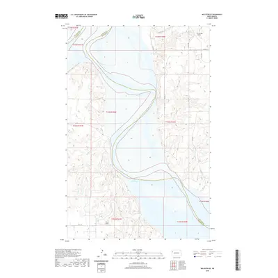
2020 Map of Williston SE
USGS Topo · Published 2020About this map
Lake Sakakawea dominates this section of the Missouri River valley where Williams and McKenzie counties meet. The landscape is defined by the expansive reservoir and the deep coulees and creeks that feed it, including the curiously named Crazy Man Coulee to the northeast and Indian Cr and Willow Cr to the south. This modern survey reflects the modern infrastructure of the northern plains, featuring the Lindvig Airstrip and a network of rural section-line roads such as 49th St NW and 132nd Rd NW. The terrain shows a transition from the elevated plains down to the water's edge, highlighting the topographical complexity of the river bluffs before they submerge into the depths of the lake.
Find a feature on this map
21 named features on this map. Tap any name to fly to it.
Don’t see what you’re looking for? This feature index may not catch every label — zoom into the map to look around manually.
Map Details
Editions of this 2020 Williston SE Map
This is the sole edition of this map. No revisions or reprints were ever made.
Other maps of this area

1911 · Ray
USGS Topo · 1:125,000

1953 · Williston
USGS Topo · 1:250,000

1953 · Watford City
USGS Topo · 1:250,000

1957 · Williston
USGS Topo · 1:250,000

1957 · Watford City
USGS Topo · 1:250,000

1959 · Williston West
USGS Topo · 1:24,000

1959 · Williston East
USGS Topo · 1:24,000

1967 · Watford City
USGS Topo · 1:250,000

1978 · Lake Jessie
USGS Topo · 1:24,000

1978 · Watford City NW
USGS Topo · 1:24,000