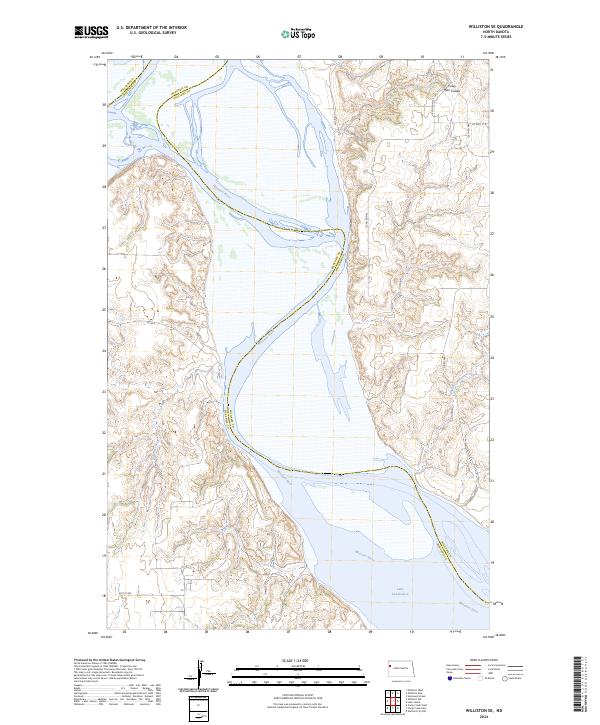
2024 Map of Williston SE
USGS Topo · Published 2024About this map
The Missouri River cuts a sweeping path through this portion of McKenzie County, defining the rugged border with Williams County to the north. This modern survey illustrates the current hydrologic profile of the region, where the river widens into the western reaches of Lake Sakakawea. The surrounding landscape is characterized by the intricate drainage systems of Indian Creek and Willow Creek, which feed into the main river valley. On the higher elevations to the northeast, the curiously named Crazy Man Coulee provides a distinct geographical landmark. The map detail reflects the rural infrastructure of western North Dakota, dominated by section-line roads such as Co Hwy 11 A and Co Rd 4, which facilitate movement across the dissected plains above the Missouri breaks.
Find a feature on this map
19 named features on this map. Tap any name to fly to it.
Don’t see what you’re looking for? This feature index may not catch every label — zoom into the map to look around manually.
Map Details
Editions of this 2024 Williston SE Map
This is the sole edition of this map. No revisions or reprints were ever made.
Other maps of this area

1911 · Ray
USGS Topo · 1:125,000

1953 · Williston
USGS Topo · 1:250,000

1953 · Watford City
USGS Topo · 1:250,000

1957 · Williston
USGS Topo · 1:250,000

1957 · Watford City
USGS Topo · 1:250,000

1959 · Williston West
USGS Topo · 1:24,000

1959 · Williston East
USGS Topo · 1:24,000

1967 · Watford City
USGS Topo · 1:250,000

1978 · Lake Jessie
USGS Topo · 1:24,000

1978 · Watford City NW
USGS Topo · 1:24,000