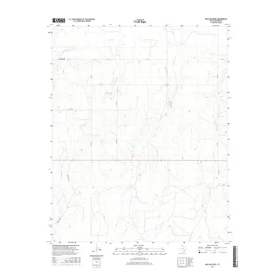
2016 Map of Willow Creek
USGS Topo · Published 2016About this map
Lipscomb stands as the primary settlement in this High Plains region of the Texas Panhandle, situated near the confluence where Plum Cr meets Wolf Cr. The landscape is defined by a dendritic drainage pattern of seasonal creeks that carve into the plateau, including the long reaches of Cottonwood Cr and Willow Cr. Ranching infrastructure dominates the rural landscape, as evidenced by the network of secondary routes like Tyson Ranch Rd and Kirk Ranch Rd that connect isolated properties across the terrain. Farther east, Canyon Cr and FM 1454 provide additional orientation within this sparsely populated portion of Lipscomb County. The map captures the modern distribution of family ranch lands and the essential watercourses that have historically dictated the placement of homesteads and roads in this arid environment.
Find a feature on this map
18 named features on this map. Tap any name to fly to it.
Don’t see what you’re looking for? This feature index may not catch every label — zoom into the map to look around manually.
Map Details
Editions of this 2016 Willow Creek Map
This is the sole edition of this map. No revisions or reprints were ever made.
Other maps of this area

1954 · Perryton
USGS Topo · 1:250,000

1958 · Perryton
USGS Topo · 1:250,000

1972 · Follett SE
USGS Topo · 1:24,000

1972 · Dugout Creek
USGS Topo · 1:24,000

1972 · Skunk Creek
USGS Topo · 1:24,000
1972 · Higgins North
USGS Topo · 1:24,000

1972 · Glazier
USGS Topo · 1:24,000

1972 · Willow Creek
USGS Topo · 1:24,000
1972 · Higgins South
USGS Topo · 1:24,000

1972 · Lipscomb
USGS Topo · 1:24,000