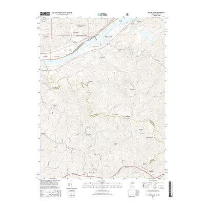
2014 Map of Willow Island
USGS Topo · Published 2014About this map
The Ohio River forms the central artery of this landscape, separating the borderlands of West Virginia and Ohio. On the West Virginia side, the topography is defined by the steep ridges of Hannan Ridge and the Buzzard Rocks formation. A network of rural settlements including Newlandsville, Borland, and Sandhill are connected by narrow winding roads like Cabin Ridge Rd and Ball Run Rd. The area's industrial legacy is preserved in the location of the Volcano Oil Field near the Ritchie County line.
Find a feature on this map
97 named features on this map. Tap any name to fly to it.
Don’t see what you’re looking for? This feature index may not catch every label — zoom into the map to look around manually.
Map Details
Editions of this 2014 Willow Island Map
This is the sole edition of this map. No revisions or reprints were ever made.
Other maps of this area

1904 · Marietta
USGS Topo · 1:62,500

1906 · Saint Marys
USGS Topo · 1:62,500

1906 · Elizabeth
USGS Topo · 1:62,500

1907 · Harrisville
USGS Topo · 1:62,500

1924 · St Marys
USGS Topo · 1:62,500

1924 · Harrisville
USGS Topo · 1:62,500

1924 · Marietta
USGS Topo · 1:62,500

1924 · Elizabeth
USGS Topo · 1:62,500

1926 · Elizabeth
USGS Topo · 1:62,500

1926 · Harrisville
USGS Topo · 1:62,500