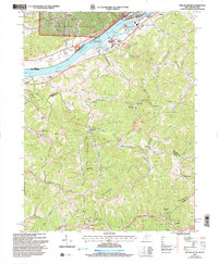
2002 Map of Willow Island
USGS Topo · Published 2006About this map
The Ohio River corridor north of Parkersburg defines this landscape, where industrial infrastructure meets the steep wooded hills of the Wayne National Forest. Significant river engineering is anchored by the Willow Island Locks and Dam, while the river's ecological character is preserved within the Ohio River Islands Nat Wildlife Ref. Away from the water, the terrain rises sharply toward Middle Ridge and Hannah Ridge, revealing a traditional Appalachian settlement pattern of ridge-top roads and creek-bottom communities. Local history is deeply embedded in the rural landscape through family and community landmarks like the Pumpkin Knob Sch and several country churches, including Harness Ch and Nash Springs Ch. The map also documents the region's energy and extractive roots, showing numerous oil wells scattered across the drainages of Horseneck Run and Bull Creek, alongside active Strip Mines north of Willow Island.
Find a feature on this map
52 named features on this map. Tap any name to fly to it.
Don’t see what you’re looking for? This feature index may not catch every label — zoom into the map to look around manually.
Map Details
Editions of this 2002 Willow Island Map
This is the sole edition of this map. No revisions or reprints were ever made.
Other maps of this area

1904 · Marietta
USGS Topo · 1:62,500

1906 · Saint Marys
USGS Topo · 1:62,500

1906 · Elizabeth
USGS Topo · 1:62,500

1907 · Harrisville
USGS Topo · 1:62,500

1924 · St Marys
USGS Topo · 1:62,500

1924 · Harrisville
USGS Topo · 1:62,500

1924 · Marietta
USGS Topo · 1:62,500

1924 · Elizabeth
USGS Topo · 1:62,500

1926 · Elizabeth
USGS Topo · 1:62,500

1926 · Harrisville
USGS Topo · 1:62,500