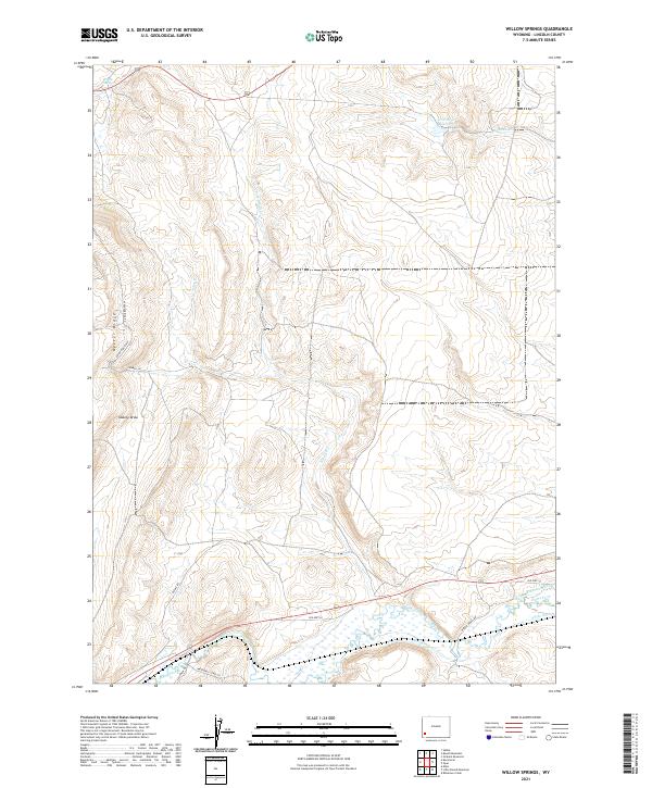
2021 Map of Willow Springs
USGS Topo · Published 2021About this map
Oyster Ridge dominates the western landscape of this Lincoln County region, where the high desert terrain is defined by complex drainage systems and early water management infrastructure. The hydrology of the area is centered around the Hams Fork river and its tributaries like Alkali Cr and Craven Cr. Human modification of this arid environment is evident in the network of irrigation features near the southern border, including the Roberson Ditch, S Side-Ditch, and Wright Ditch.
Find a feature on this map
23 named features on this map. Tap any name to fly to it.
Don’t see what you’re looking for? This feature index may not catch every label — zoom into the map to look around manually.
Map Details
Editions of this 2021 Willow Springs Map
This is the sole edition of this map. No revisions or reprints were ever made.
Other maps of this area

1954 · Ogden
USGS Topo · 1:250,000

1954 · Kemmerer
USGS Topo · 1:62,500

1958 · Ogden
USGS Topo · 1:250,000

1960 · Ogden
USGS Topo · 1:250,000

1962 · Elkol
USGS Topo · 1:24,000

1969 · Willow Springs
USGS Topo · 1:24,000

1969 · Roberson Creek
USGS Topo · 1:24,000
1969 · Round Mountain
USGS Topo · 1:24,000
1969 · Opal
USGS Topo · 1:24,000
1969 · Graham Reservoir
USGS Topo · 1:24,000