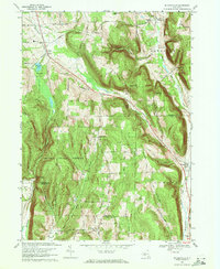
1969 Map of Willseyville
USGS Topo · Published 1976About this map
The Lehigh Valley railroad corridor defines the eastern valley of this New York landscape, threading through the rural communities of Caroline and Willseyville. Heavily forested slopes within the Danby State Forest dominate the central terrain, rising toward landmarks like Durfee Hill and Eastman Hill. These wooded ridges create a sharp contrast with the settled clearings of Danby and South Danby, where local life centered around the Danby Sch and several small cemeteries like Danby Rural Cem.
Find a feature on this map
41 named features on this map. Tap any name to fly to it.
Don’t see what you’re looking for? This feature index may not catch every label — zoom into the map to look around manually.
Map Details
Editions of this 1969 Willseyville Map
4 editions found
Other maps of this area

1893 · Ithaca
USGS Topo · 1:62,500

1895 · Ithaca
USGS Topo · 1:62,500

1900 · Dryden
USGS Topo · 1:62,500

1902 · Waverly
USGS Topo · 1:62,500

1903 · Owego
USGS Topo · 1:62,500

1905 · Watkins Glen
USGS Topo · 1:125,000

1906 · Catatonk
USGS Topo · 1:125,000

1949 · Ithaca West
USGS Topo · 1:24,000

1949 · Ithaca East
USGS Topo · 1:24,000

1949 · Willseyville
USGS Topo · 1:24,000