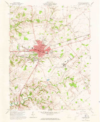
1961 Map of Wilmington
USGS Topo · Published 1973About this map
The intersection of the Pennsylvania and Baltimore And Ohio railroads anchors the city of Wilmington, serving as a central hub for Clinton County in the early 1960s. This survey reveals a community balanced between its academic roots at Wilmington College and a significant military presence at the Clinton County Air Force Base to the southeast. The base, complete with its Control Tower and Base Chapel, stands in contrast to the surrounding agricultural landscape of Union and Washington townships.
Find a feature on this map
43 named features on this map. Tap any name to fly to it.
Don’t see what you’re looking for? This feature index may not catch every label — zoom into the map to look around manually.
Map Details
Editions of this 1961 Wilmington Map
4 editions found
Other maps of this area

1907 · Blanchester
USGS Topo · 1:62,500

1916 · Octa
USGS Topo · 1:62,500

1917 · Xenia
USGS Topo · 1:62,500

1917 · Sabina
USGS Topo · 1:62,500

1943 · Sabina
USGS Topo · 1:62,500

1944 · Octa
USGS Topo · 1:62,500

1947 · Columbus
USGS Topo · 1:250,000

1955 · New Burlington
USGS Topo · 1:24,000

1955 · Port William
USGS Topo · 1:24,000

1960 · Martinsville
USGS Topo · 1:24,000