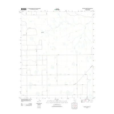
2012 Map of Wilson Creek
USGS Topo · Published 2012About this map
Quitaque Cr and its tributaries carve a network through this section of the Texas Panhandle, defining a landscape marked by ranching and rural navigation. Private holdings like Woods Ranch and Johnfarris stand as primary landmarks within a grid of county roads, where the drainage of Wilson Cr and Emerson Cr breaks the plateau's surface. The map documents the area's infrastructure, from the essential passage of Ranch Road 97 and Ranch Road 2286 to the numerous designated county routes that connect isolated homesteads and grazing lands. This survey captures a moment in the modern ranching era of Floyd County, illustrating how local travel and property boundaries remain closely tied to the natural watercourses that traverse the dry plains.
Find a feature on this map
23 named features on this map. Tap any name to fly to it.
Don’t see what you’re looking for? This feature index may not catch every label — zoom into the map to look around manually.
Map Details
Editions of this 2012 Wilson Creek Map
This is the sole edition of this map. No revisions or reprints were ever made.
Other maps of this area

1954 · Plainview
USGS Topo · 1:250,000

1958 · Plainview
USGS Topo · 1:250,000

1965 · Whiteley
USGS Topo · 1:24,000

1965 · Lockney SE
USGS Topo · 1:24,000

1966 · South Plains
USGS Topo · 1:24,000

1966 · Lockney 4 SW
USGS Topo · 1:24,000

1967 · Quitaque
USGS Topo · 1:24,000

1967 · Quitaque Peaks
USGS Topo · 1:24,000

1967 · Dick Moore Canyon
USGS Topo · 1:24,000

1967 · Edgemon Lake
USGS Topo · 1:24,000