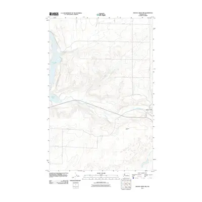
2011 Map of Wilson Creek NW
USGS Topo · Published 2011About this map
Crab Creek winds through the southern portion of this Grant County landscape, carving a prominent valley that dictates the local infrastructure and settlement patterns. The community of Wilson Creek sits at the eastern edge of the quadrangle, where the creek's drainage meets the intersection of local routes like Lincoln Rd and 24-Ne RD. This area shows the distinct transition from the high, plateau-like terrain to the north—marked by a grid of rural roads such as 26 Northeast Rd—to the lower riparian corridor. To the west, the presence of Billy Clapp Lake and Brook Lake highlights the significant water management and geological features that define this part of the Washington interior. These water bodies, situated amidst the dramatic elevation changes, provide a stark contrast to the surrounding agricultural and range lands. The map also identifies the smaller settlement area of West Wilson Creek, illustrating the dispersed nature of habitation in this eastern Washington canyon country.
Find a feature on this map
21 named features on this map. Tap any name to fly to it.
Don’t see what you’re looking for? This feature index may not catch every label — zoom into the map to look around manually.
Map Details
Editions of this 2011 Wilson Creek NW Map
This is the sole edition of this map. No revisions or reprints were ever made.
Other maps of this area

1953 · Ritzville
USGS Topo · 1:250,000

1956 · Stratford
USGS Topo · 1:24,000

1956 · Gloyd
USGS Topo · 1:24,000

1956 · Wilson Creek SW
USGS Topo · 1:24,000

1956 · Wilson Creek SE
USGS Topo · 1:24,000

1956 · Wilson Creek NW
USGS Topo · 1:24,000

1956 · Wilson Creek
USGS Topo · 1:62,500

1959 · Ritzville
USGS Topo · 1:250,000

1965 · Ritzville
USGS Topo · 1:250,000

1965 · Coulee City
USGS Topo · 1:24,000