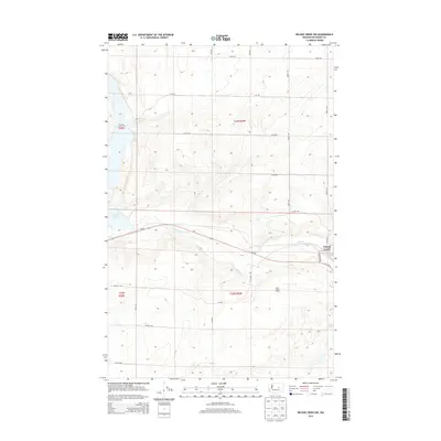
2014 Map of Wilson Creek NW
USGS Topo · Published 2014About this map
Crab Creek snakes through the high plateau of the Washington backcountry, defining the lower valley where the settlement of Wilson Creek and its neighboring West Wilson Creek are situated. This 2014 survey captures a landscape dominated by the geometry of the Public Land Survey System, with township lines like t23n r29e and t22n r29e overlaying the coulee-carved terrain. The map documents an essential agricultural and transit corridor, where Wa-28 runs parallel to the creek and a network of gravel section roads—such as Road 22 NE and Road Q NE—connects the remote uplands. Small water bodies like Brook Lake and Soda Lake appear as distinct basins within the surrounding benchlands, illustrating the unique drainage patterns of this corner of Grant County.
Find a feature on this map
24 named features on this map. Tap any name to fly to it.
Don’t see what you’re looking for? This feature index may not catch every label — zoom into the map to look around manually.
Map Details
Editions of this 2014 Wilson Creek NW Map
This is the sole edition of this map. No revisions or reprints were ever made.
Other maps of this area

1953 · Ritzville
USGS Topo · 1:250,000

1956 · Stratford
USGS Topo · 1:24,000

1956 · Gloyd
USGS Topo · 1:24,000

1956 · Wilson Creek SW
USGS Topo · 1:24,000

1956 · Wilson Creek SE
USGS Topo · 1:24,000

1956 · Wilson Creek NW
USGS Topo · 1:24,000

1956 · Wilson Creek
USGS Topo · 1:62,500

1959 · Ritzville
USGS Topo · 1:250,000

1965 · Ritzville
USGS Topo · 1:250,000

1965 · Coulee City
USGS Topo · 1:24,000