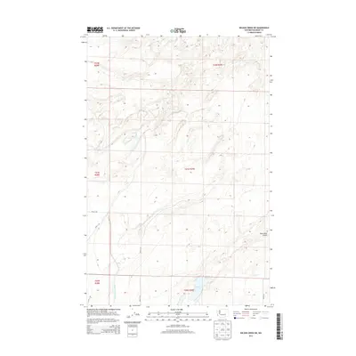
2014 Map of Wilson Creek SW
USGS Topo · Published 2014About this map
Black Lake and the surrounding arid landscape of Grant County define this 2014 survey. The terrain is marked by distinctive geological depressions and water management infrastructure, most notably the Sand Coulee Siphon in the southwest. This area of Washington's central plateau is characterized by the coulee formations typical of the region's volcanic history, including the prominent Black Rock Coulee. The map details a rectilinear network of rural routes such as Road 14 NE and Road M NE, which segment the landscape into systematic sections for land management. This survey provides a precise view of the hydrological and topographic features in a sparsely settled part of the state where water movement and natural drainages dictate the use of the land.
Find a feature on this map
14 named features on this map. Tap any name to fly to it.
Don’t see what you’re looking for? This feature index may not catch every label — zoom into the map to look around manually.
Map Details
Editions of this 2014 Wilson Creek SW Map
This is the sole edition of this map. No revisions or reprints were ever made.
Other maps of this area

1912 · Moses Lake
USGS Topo · 1:62,500

1923 · Wheeler
USGS Topo · 1:62,500

1925 · Wheeler
USGS Topo · 1:62,500

1953 · Ritzville
USGS Topo · 1:250,000

1956 · Wheeler
USGS Topo · 1:24,000

1956 · Stratford
USGS Topo · 1:24,000

1956 · Moses Lake North
USGS Topo · 1:24,000

1956 · Gloyd
USGS Topo · 1:24,000

1956 · Wilson Creek SW
USGS Topo · 1:24,000

1956 · Wheeler NE
USGS Topo · 1:24,000