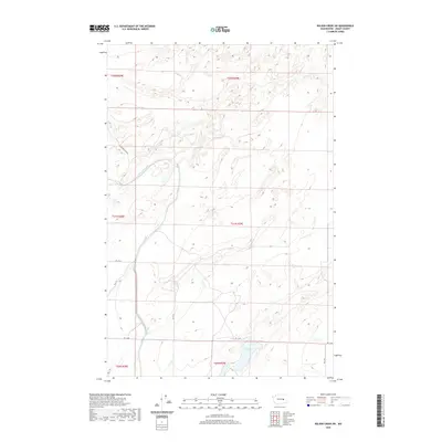
2020 Map of Wilson Creek SW
USGS Topo · Published 2020About this map
East Low Canal carves a distinct path through this section of the Columbia Basin in Grant County, serving as a vital piece of the region's agricultural infrastructure. The man-made waterway dominates the western half of the landscape, accompanied by E Low Canal Rd NE as it winds through the township divisions of T21N and T22N. This modern survey illustrates the precision of the Public Land Survey System, with a network of rural routes such as Rd 14 NE and Rd 12 NE following section lines across the arid terrain. In the southern reaches, the natural depression of Black Lake provides a sharp contrast to the surrounding plateau. The map captures the stark, utilitarian beauty of the High Desert's managed water systems and the geometric precision of Washington's inland farming and ranching country.
Find a feature on this map
15 named features on this map. Tap any name to fly to it.
Don’t see what you’re looking for? This feature index may not catch every label — zoom into the map to look around manually.
Map Details
Editions of this 2020 Wilson Creek SW Map
This is the sole edition of this map. No revisions or reprints were ever made.
Other maps of this area

1912 · Moses Lake
USGS Topo · 1:62,500

1923 · Wheeler
USGS Topo · 1:62,500

1925 · Wheeler
USGS Topo · 1:62,500

1953 · Ritzville
USGS Topo · 1:250,000

1956 · Wheeler
USGS Topo · 1:24,000

1956 · Stratford
USGS Topo · 1:24,000

1956 · Moses Lake North
USGS Topo · 1:24,000

1956 · Gloyd
USGS Topo · 1:24,000

1956 · Wilson Creek SW
USGS Topo · 1:24,000

1956 · Wheeler NE
USGS Topo · 1:24,000