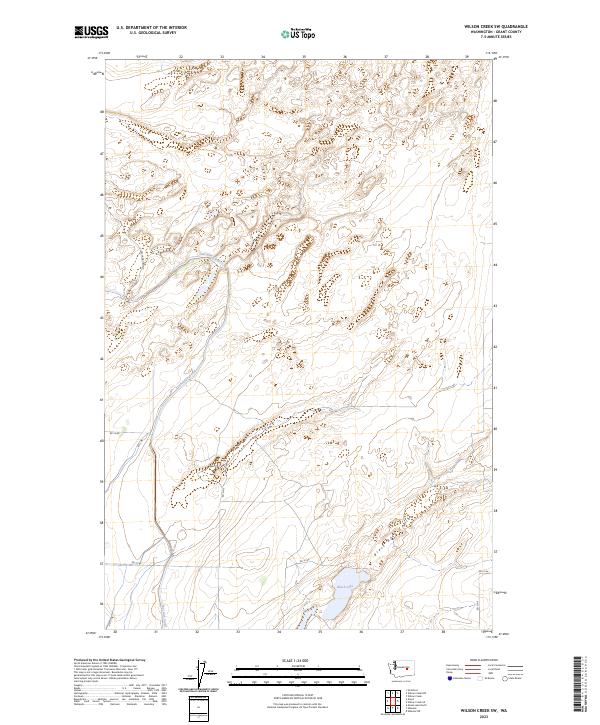
2023 Map of Wilson Creek SW
USGS Topo · Published 2023About this map
East Low Canal carves a distinct line through this corner of Grant County, illustrating the extensive irrigation infrastructure central to the region's agricultural character. This 2023 survey highlights a landscape defined by the basalt geology of the Channeled Scablands, where the broad, dry floor of Black Rock Coulee snakes across the southern sections of the quadrangle. A system of gravel roads, including E Low Canal Rd Ne and Rd 14 Ne, follows the township and range lines established by the Public Land Survey System, providing access to this open terrain. Black Lake serves as a primary water feature in an otherwise arid expanse, marking a low point in the local topography where seasonal or managed water collects amidst the coulees and draws.
Find a feature on this map
16 named features on this map. Tap any name to fly to it.
Don’t see what you’re looking for? This feature index may not catch every label — zoom into the map to look around manually.
Map Details
Editions of this 2023 Wilson Creek SW Map
This is the sole edition of this map. No revisions or reprints were ever made.
Other maps of this area

1912 · Moses Lake
USGS Topo · 1:62,500

1923 · Wheeler
USGS Topo · 1:62,500

1925 · Wheeler
USGS Topo · 1:62,500

1953 · Ritzville
USGS Topo · 1:250,000

1956 · Wheeler
USGS Topo · 1:24,000

1956 · Stratford
USGS Topo · 1:24,000

1956 · Moses Lake North
USGS Topo · 1:24,000

1956 · Gloyd
USGS Topo · 1:24,000

1956 · Wilson Creek SW
USGS Topo · 1:24,000

1956 · Wheeler NE
USGS Topo · 1:24,000