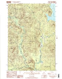
1989 Map of Wilsons Mills
USGS Topo · Published 1989About this map
The Magalloway River and its confluence with the Dead Diamond River define the intricate drainage patterns of this borderland in the late 1980s. Straddling the Maine and New Hampshire line, the map details several distinct land grants and townships, including the Second College Grant and Atkinson and Gilmanton Academy Grant. The settlement of Wilsons Mills sits at a critical junction of river and road, serving as a hub for the surrounding timberlands and sporting lodges like Alice Lodge and Linda Lodge. Evidence of localized aviation and industry appears through the Miller-Quinn Landing Strip and a nearby Gravel Pit. The terrain is marked by colorful local nomenclature such as Emerys Misery, Hell Gate, and Monshans Bathtub, reflecting a landscape deeply known by those who worked and traveled these remote northern woods.
Find a feature on this map
50 named features on this map. Tap any name to fly to it.
Don’t see what you’re looking for? This feature index may not catch every label — zoom into the map to look around manually.
Map Details
Editions of this 1989 Wilsons Mills Map
2 editions found
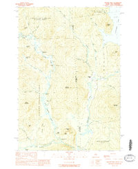
Other maps of this area

1927 · Second Lake
USGS Topo · 1:62,500

1930 · Errol
USGS Topo · 1:62,500

1931 · Cupsuptic
USGS Topo · 1:48,000

1932 · Second Lake
USGS Topo · 1:62,500

1934 · Cupsuptic
USGS Topo · 1:62,500

1934 · Errol
USGS Topo · 1:62,500

1935 · Cupsuptic
USGS Topo · 1:62,500

1940 · Oquossoc
USGS Topo · 1:62,500

1942 · Oquossoc
USGS Topo · 1:62,500

1949 · Jackman
USGS Topo · 1:250,000
Featured Places
- Magalloway Plantation, ME
- Lincoln Plantation, ME
- Atkinson and Gilmanton Academy Grant, NH
- Second College Grant, NH
- Wilsons Mills, Lincoln Plantation