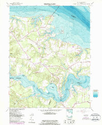
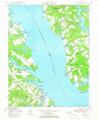
1964 Map of Wilton
USGS Topo · Published 1986About this map
The coastal reaches of Middlesex and Gloucester counties are defined by the wide waters of the Rappahannock River and the Piankatank River in the mid-1960s. This survey, updated with 1980s aerial data and bathymetric soundings, reveals a landscape deeply connected to the Chesapeake tidewater through numerous wharves and landings. Small crossroads like Harmony Village, Hartfield, and Syringa are linked by a network of rural roads that cross prominent features like Barricks Millpond and lead to active waterfront hubs including Stampers Wharf and Blands Wharf.
Find a feature on this map
70 named features on this map. Tap any name to fly to it.
Don’t see what you’re looking for? This feature index may not catch every label — zoom into the map to look around manually.
Map Details
Editions of this 1964 Wilton Map
4 editions found
Other maps of this area

1906 · Williamsburg
USGS Topo · 1:62,500

1916 · Kilmarnock
USGS Topo · 1:48,000

1916 · Mathews
USGS Topo · 1:62,500

1917 · Urbanna
USGS Topo · 1:62,500

1917 · Kilmarnock
USGS Topo · 1:62,500

1917 · Mathews
USGS Topo · 1:62,500

1942 · Kilmarnock
USGS Topo · 1:62,500

1943 · Richmond
USGS Topo · 1:250,000
1946 · Urbanna
USGS Topo · 1:24,000

1948 · Ware Neck
USGS Topo · 1:24,000