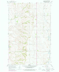
1966 Map of Wilton SE
USGS Topo · Published 1977About this map
Wogansport and the Missouri River bluffs define the western edge of this North Dakota landscape during the mid-1960s and 1970s. The terrain transitions from the river valley into the upland areas of Painted Woods, Ecklund, and Glenview. Settlement is sparse and follows the higher ground, anchored by rural landmarks like Rosehill Cem, School No 1, and School No 2.
Find a feature on this map
15 named features on this map. Tap any name to fly to it.
Don’t see what you’re looking for? This feature index may not catch every label — zoom into the map to look around manually.
Map Details
Editions of this 1966 Wilton SE Map
2 editions found

Other maps of this area

1907 · Bismarck
USGS Topo · 1:125,000

1950 · Wilton
USGS Topo · 1:62,500

1951 · Bismarck
USGS Topo · 1:62,500

1951 · Menoken
USGS Topo · 1:62,500

1954 · Bismarck
USGS Topo · 1:250,000

1954 · McClusky
USGS Topo · 1:250,000

1958 · Bismarck
USGS Topo · 1:250,000

1958 · McClusky
USGS Topo · 1:250,000

1962 · Harmon
USGS Topo · 1:24,000
1962 · Burnt Butte
USGS Topo · 1:24,000