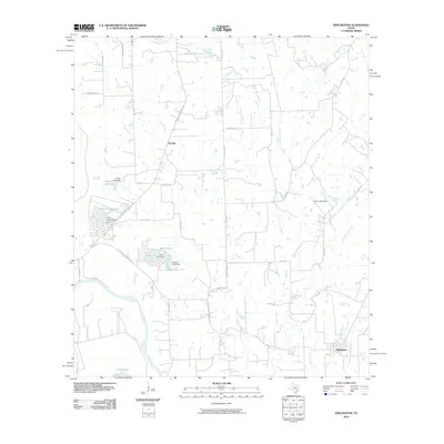
2010 Map of Winchester
USGS Topo · Published 2010About this map
The Colorado River winds through the southeastern corner of this Central Texas landscape, defining the rural character of the region near Winchester. This area is characterized by a network of small creeks and branches, including Willow Creek, Grassy Creek, and Knobbs Creek, which feed into the primary river system. Local land use is reflected in features like the Madison Ranch and the small community of Pin Oak, which sits central to a web of farm-to-market and county roads.
Find a feature on this map
52 named features on this map. Tap any name to fly to it.
Don’t see what you’re looking for? This feature index may not catch every label — zoom into the map to look around manually.
Map Details
Editions of this 2010 Winchester Map
This is the sole edition of this map. No revisions or reprints were ever made.
Other maps of this area

1885 · Bastrop
USGS Topo · 1:125,000

1893 · Bastrop
USGS Topo · 1:125,000

1901 · Flatonia
USGS Topo · 1:125,000

1904 · Bastrop
USGS Topo · 1:125,000

1919 · Giddings
USGS Topo · 1:62,500

1948 · Smithville
USGS Topo · 1:62,500

1950 · Smithville
USGS Topo · 1:62,500

1953 · Seguin
USGS Topo · 1:250,000

1954 · Austin
USGS Topo · 1:250,000

1956 · La Grange
USGS Topo · 1:62,500