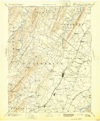
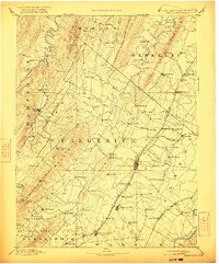
1894 Map of Winchester
USGS Topo · Published 1932About this map
The West Virginia Virginia Boundary Line cuts diagonally through this late nineteenth-century survey, dividing the Appalachian ridges and the fertile Shenandoah Valley. Topography is defined by the parallel elevations of Great North Mountain, Little North Mountain, and Sleepy Creek Mountain, which funnel settlement into the intervening gaps and valleys. Local commerce and transit are centered on the rail networks of the Cumberland Valley Railroad and the Baltimore and Ohio Railroad Valley Branch, which connect rural hubs like Inwood, Bunker Hill, and Gerrardstown. Along the Shenandoah River and the North Branch Cacapon River, numerous smaller communities such as Bloomery and Capon Bridge represent the established crossroads of the era. The mapping reflects a landscape of small stores and post offices, like Unger Store, serving a dispersed agricultural population prior to modern infrastructure.
Find a feature on this map
103 named features on this map. Tap any name to fly to it.
Don’t see what you’re looking for? This feature index may not catch every label — zoom into the map to look around manually.
Map Details
Editions of this 1894 Winchester Map
6 editions found
Other maps of this area

1884 · Harpers Ferry
USGS Topo · 1:125,000

1891 · Harpers Ferry
USGS Topo · 1:125,000

1891 · Romney
USGS Topo · 1:125,000

1892 · Woodstock
USGS Topo · 1:125,000

1893 · Luray
USGS Topo · 1:125,000

1893 · Harpers Ferry
USGS Topo · 1:125,000

1894 · Warrenton
USGS Topo · 1:125,000

1894 · Winchester
USGS Topo · 1:125,000

1898 · Paw Paw
USGS Topo · 1:62,500

1899 · Flintstone
USGS Topo · 1:62,500