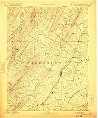
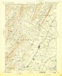
1894 Map of Winchester
USGS Topo · Published 1922About this map
Winchester serves as the focal point of this late 19th-century reconnaissance, situated at the nexus of the Baltimore and Ohio Railroad Valley Branch and the historic Cumberland Road. The map documents a landscape defined by sharp mountain ridges including Cacapon Mtn. and North Mountain, which dictated the early transportation corridors and settlement patterns of the Shenandoah Valley. Numerous small communities, many of which remain today as key genealogical markers, are detailed across the West Virginia-Virginia border.
Find a feature on this map
117 named features on this map. Tap any name to fly to it.
Don’t see what you’re looking for? This feature index may not catch every label — zoom into the map to look around manually.
Map Details
Editions of this 1894 Winchester Map
6 editions found
Other maps of this area

1884 · Harpers Ferry
USGS Topo · 1:125,000

1891 · Harpers Ferry
USGS Topo · 1:125,000

1891 · Romney
USGS Topo · 1:125,000

1892 · Woodstock
USGS Topo · 1:125,000

1893 · Luray
USGS Topo · 1:125,000

1893 · Harpers Ferry
USGS Topo · 1:125,000

1894 · Warrenton
USGS Topo · 1:125,000

1894 · Winchester
USGS Topo · 1:125,000

1898 · Paw Paw
USGS Topo · 1:62,500

1899 · Flintstone
USGS Topo · 1:62,500