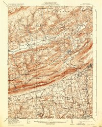
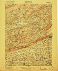
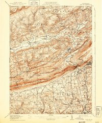
1916 Map of Wind Gap
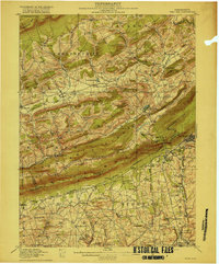
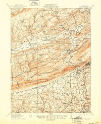
USGS Topo · Published 1937About this map
Blue Mountain forms a dramatic diagonal spine across this region of Pennsylvania, separating the lower-elevation townships of Bushkill and Moore from the interior ridges of Weir Mountain and Cherry Ridge. The landscape is defined by the strategic passage at Wind Gap, a natural breach in the mountain that served as a critical corridor for both the Lehigh and New England and the Saylorsburg and New England transit lines. The map reveals a dense network of early 20th-century rural infrastructure, characterized by numerous local landmarks like Haynes Mill and Souers Mills.
Find a feature on this map
111 named features on this map. Tap any name to fly to it.
Don’t see what you’re looking for? This feature index may not catch every label — zoom into the map to look around manually.
Map Details
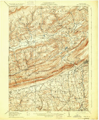
Editions of this 1916 Wind Gap Map
7 editions found
Other maps of this area

1890 · Easton
USGS Topo · 1:62,500

1891 · Easton
USGS Topo · 1:62,500

1891 · Delaware Water Gap
USGS Topo · 1:62,500

1893 · Delaware Water Gap
USGS Topo · 1:62,500

1894 · Allentown
USGS Topo · 1:62,500

1902 · Slatington
USGS Topo · 1:62,500

1914 · Wind Gap
USGS Topo · 1:62,500

1916 · Wind Gap
USGS Topo · 1:62,500

1919 · Pocono
USGS Topo · 1:62,500

1921 · Pocono
USGS Topo · 1:62,500